Hello: I'm Charles A. Giannetta: Welcome to my site: Enjoy your tour. Visit often. Thanks.

Hello: Welcome To My Site: - "Always Open"
"Weather By Giannetta"


"N O T E"
All weather articles written by the author,
weather records for Bath, Pa. USA, graphs,
graphics, pictures, are copyrighted and are owned by the author.

If you make use of data from this site,
please make reference to the: Station Licensee: Virginia T. Giannetta.
Owner - Author: Charles A. Giannetta. Computer Consultant: Charles E. Giannetta
& This Web Site. Thank you.


1. Fog: Adverse to aviation & auto travel. 2. FOG: Color White. 3. Fog: Disperses from the top down. 4. Fog: Forms at about 85 percent relative humidity. 5. Fog: Ground: Valley. 6. Fog: Produced when wind is 7 mph or less. 7. Fog: Radiation/Advection/Steam/Upslope. 8. Fog: Surface to 10,000 ft.


Steam Fog.


Meteorology               Charles A Giannetta
                       Meteorologist - Professor

"Fog"  

Fog is defined as obscurity in the surface layers of the atmosphere, caused by particles of condensed moisture held in suspension in the air. In international meteorological practice the term "Fog" is limited to a condition of the atmospheric obscurity in which objects at a distance of one kilometer (1000 meters), are not visible. When visibility exceeds this limit but is less than two kilometers, the observation is called "Mist" or (Haze) according to whether it is produced by condensed water particles or by foreign solid matter such as dust or smoke. If the accumulation of the dust or smoke in the atmosphere is great enough to reduce visibility below one kilometer, a pure dust fog or smoke fog occurs. Smoke fogs are characteristic of large towns and industrial areas. "Dust Fogs" Dust fogs are associated with the desert regions of the globe. They occur off the west coast of Africa during the season of the "HARMATTAN", a dry wind blowing from the northeast or sometimes easterly direction which carries clouds of dust form the Sahara which penetrates into houses by every crack. The dust is often carried in sufficient quantity to form a thick haze which impedes navigation on the rivers. "Fog Over Land" Fogs over land occur daily in autumn and winter. They are formed most frequently on the clam, clear nights which are associated with anti-cyclonic conditions. They reach their maximum intensity normally in the early morning between sunrise and usually disperse before midday. In winter such fogs occasionally cover a wide area and persist for some days. "London Fog" Fogs may also be formed by the passage of warm air over cold ground or by mixing or two currents of air of different temperatures. A peculiarity of the "London Area" is the formation of fog due to condensation together with an accumulation of smoke, in a layer of air above the surface. Such fogs which are usually of short duration may cause some darkness in the middle of the day.

"Fogs At Sea"

Fogs at sea unlike land fogs are characteristic of spring and summer and are usually formed by passage of a current of air formed by a large land mass, or from tropical or sub-tropical regions over the relatively cold sea. "Sea Fog" Sea fogs are sometimes so shallow that the mastheads of ships protrude above them. In certain conditions a fog has no clearly defined upper boundary but merges into clouds which may extend to considerable height. "High Level Country" High level country experiences fog at all seasons due to drifting low clouds which envelops the high ground. High ground near sea suffers the most. The height to which ordinary fog extends varies considerably. It is usually less than 1,000 ft. and frequently less than 500 ft.

The above graph represents total number of days over a 30 year perion from 1950-1980, when heavy fog reduced visibility below 1/4 mile recorded by the National Weather Service Office at the ABE Airport, Allentown, Pa. USA. The month with the lowest total number of days is June with 19, and the highest is October with 70.


Meteorology               Charles A Giannetta
                       Meteorologist - Professor

     "Different Types Of Fog"   

Fog is a cloud on the ground. Water droplets suspended in the air at the earth's surface which reduces visibility and is hazardous to aviation and the general public. "Advection Fog" Advection Fog...Occurs when warm air moves over a cold surface. When the warm moist air comes in contact with the cold surface, moisture will condense often in the form of fog. Since the bottom of the air mass is the part that is cooled, there is little mixing by convection. The moisture is then confined to the lower layers of the air. During the day the fog will lift to some extent but it will fall during the night to limit visibility and ceiling.
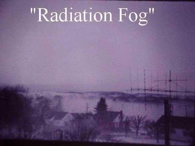
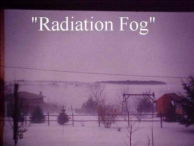
 "Radiation Fog" Radiation Fog...Is a low level fog, also called Ground Fog. Forms near the earth's surface when Longwave Radiation (IR) cools to or below its dew point It is one that you are likely to be familiar. Forms when the earth is cooled by radiation. It appears when lower layers of moist air come in contact with cold ground. This lost of heat takes place once the sun has set, and continues until the earth is warmed again by the next day's sun. This type of fog forms most during clear weather . Once the fog has started to form light winds will tend to deepen an further develop it by mixing the lower layers of air. The fog may become deep enough to limit visibility. The type of fog offers difficulty to pilots when they are attempting a landing, it may cover the ground and hide the landscape from view within a few minutes. Radiation Fog can be described as high or low according to the altitude at which it forms. "High Radiation Fog" High Radiation Fog...There are times during the winter when larges bodies of moist air remain for days over certain portions of out continent. As the earth is losing heat by radiation during a stagnation of this kind, a high radiation fog is likely to form. The ground levels lose heat first and the low-type fog forms. As the loss of heat increases with sucessive days the fog deepens and often reaches altitudes of 600 - 1,000 feet. High fogs of this type occur on the West Coast and in the Middle West. They are of longer duration that the ground fog offers considerable resistance to being dispelled by the sun's rays. High fog have been observed over much of Oregon and California and remain for as long as a few weeks.


Meteorology                           Charles A. Giannetta
                                      Meteorologist - Professor

"Steam Fog" Steam Fog.... Produced when cold air comes in contact with warm water and produces rising steam. "Valley Fog" Valley Fog...Forms when air is cooled during the evening on slopes of mountains. The air becomes heavy and sinks down the mountain slope creating cool air at the valley with the air reaching its dew point fog will form. "Upslope Fog" Upslope Fog occurs when air is lifted up a mountain adiabatically and condenses to form fog.


1. Fog: Adverse to aviation & auto travel 2. FOG: Color White. 3. Fog: Disperses from the top down. 4. Fog: Forms at about 85 percent relative humidity. 5. Fog: Ground: Valley 6. Fog: Produced when wind is 7 mph or less. 7. Fog: Radiation/Advection/Steam/Upslope. 8. Fog: Surface to 10,000 ft.


....Back to index page.

© 1998 - 2015 Charles A. Giannetta


...Back To TOP Of Page...